Uploads by UE-InfoVis0708 0525566
Jump to navigation
Jump to search
This special page shows all uploaded files.
| Date | Name | Thumbnail | Size | Description | Versions |
|---|---|---|---|---|---|
| 19:54, 26 February 2010 | Studi2.jpg (file) |  |
25 KB | 2 | |
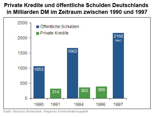
| 17:57, 13 January 2008 | Kredite Schulden verbessert.jpg (file) |  |
101 KB | Improved Graphic | 7 |
| 17:18, 3 January 2008 | PatientSoftware3 low.jpg (file) |  |
213 KB | Third screenshot showing the functionality of the software. | 2 |
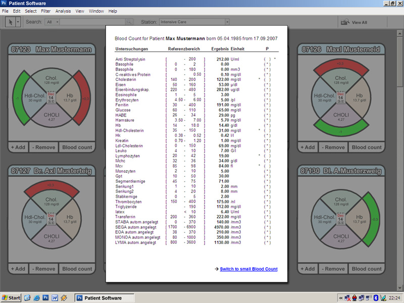
| 23:52, 2 January 2008 | PatientSoftware4 low.jpg (file) |  |
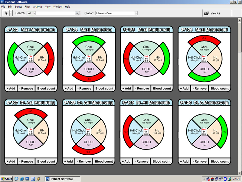
196 KB | Fourth screenshot showing the blood count of one patient. | 1 |
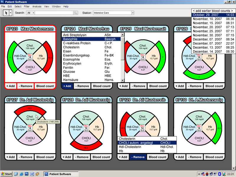
| 23:50, 2 January 2008 | PatientSoftware2 low.jpg (file) |  |
222 KB | Second screenshot showing the detailview of one patient | 1 |
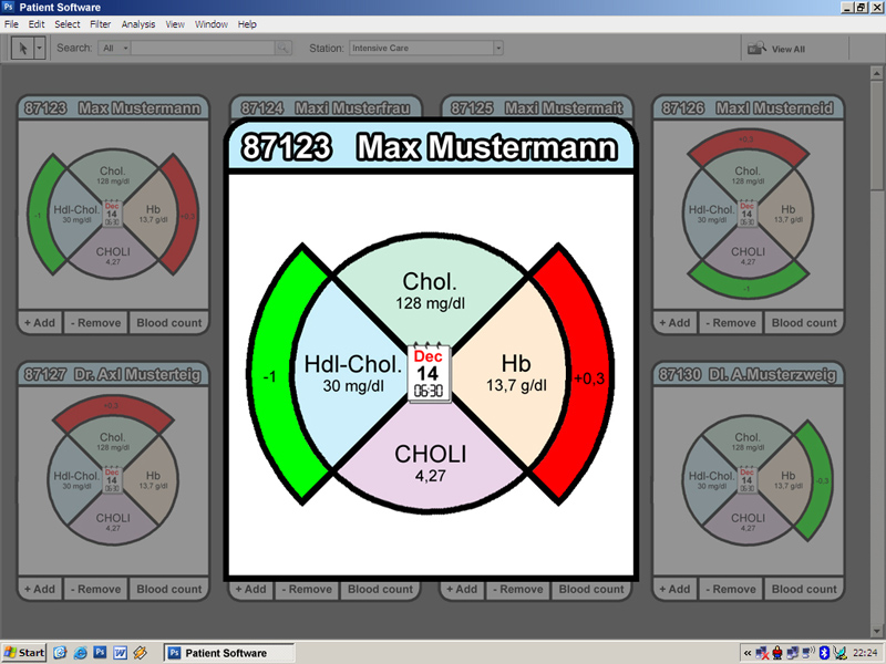
| 23:48, 2 January 2008 | PatientSoftware1 low.jpg (file) |  |
211 KB | First Screenshot showing the GUI | 1 |
| 20:21, 10 December 2007 | Gr06 tabelle 2.jpg (file) |  |
125 KB | Improved Table | 2 |
| 16:44, 23 November 2007 | Gr06 tabelle.jpg (file) |  |
115 KB | Improved Table | 1 |
| 18:32, 9 November 2007 | Isopleth map.jpg (file) |  |
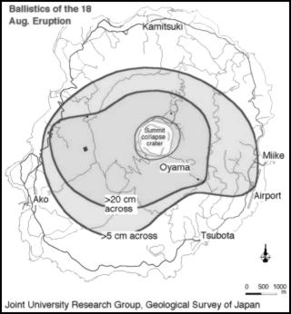
19 KB | Example Isopleth map | 1 |
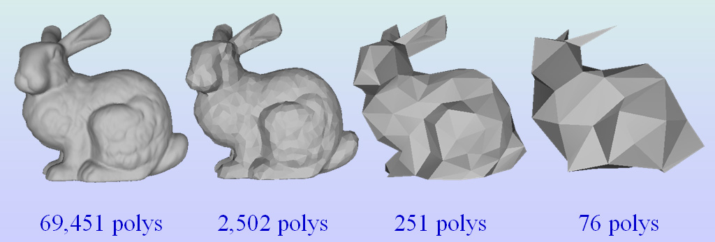
| 15:31, 9 November 2007 | LOD5.jpg (file) |  |
127 KB | Hierarchical LOD | 1 |
| 15:30, 9 November 2007 | LOD4.jpg (file) |  |
98 KB | View Dependent LOD | 1 |
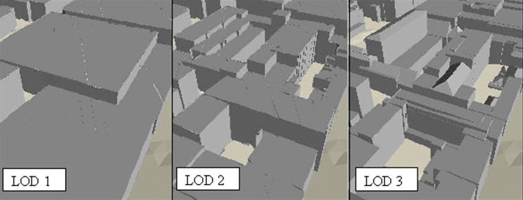
| 15:29, 9 November 2007 | LOD3.jpg (file) |  |
94 KB | Continous LOD | 1 |
| 15:28, 9 November 2007 | LOD2.jpg (file) |  |
99 KB | Maximum detail of an object for close-ups and a minimum of detail for very far away objects. | 1 |
| 15:26, 9 November 2007 | LOD1.jpg (file) |  |
93 KB | Maximum to minimum LOD | 1 |
| 00:16, 9 November 2007 | Zoom2 lowres.jpg (file) |  |
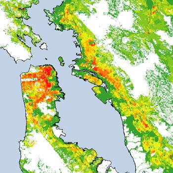
51 KB | Dasymetric example | 1 |
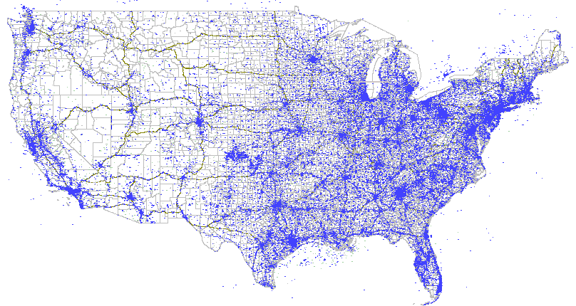
| 00:15, 9 November 2007 | Tower maps large.gif (file) |  |
42 KB | Dot example | 1 |
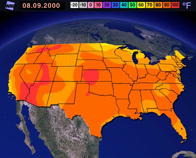
| 00:14, 9 November 2007 | Weather.jpg (file) |  |
67 KB | Isarithmic example | 1 |
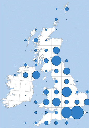
| 00:13, 9 November 2007 | Map100km.png (file) |  |
31 KB | Proportional Symbol example | 1 |
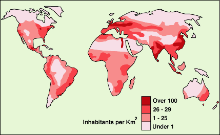
| 00:11, 9 November 2007 | G156.gif (file) |  |
14 KB | Choropleth example | 1 |
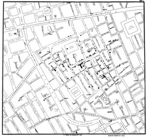
| 00:10, 9 November 2007 | 300px-Snow-cholera-map-1.jpg (file) |  |
28 KB | Thematic map created by John Snow in 1855. | 1 |
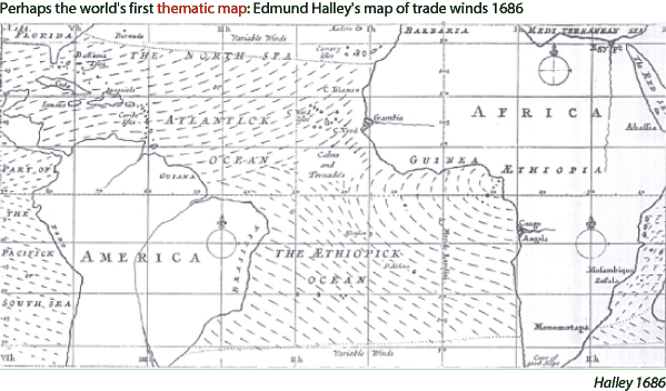
| 00:06, 9 November 2007 | Halley.gif (file) |  |
67 KB | The first map created by Edmond Halley including the information of the direction of trade winds in the Atlantic Ocean. | 1 |