File:Weather map.jpg
Jump to navigation
Jump to search
No higher resolution available.
Weather_map.jpg (551 × 397 pixels, file size: 133 KB, MIME type: image/jpeg)
Summary[edit]
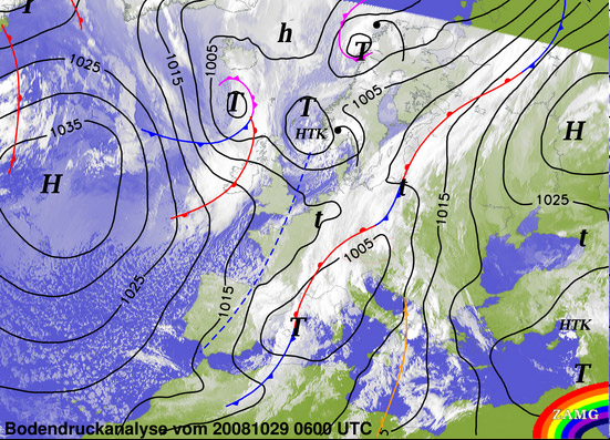
The map shows the analysis of the weather condition.
Copyright status[edit]
ZAMG
Source[edit]
Wetter-Server Österreich, Bodenwetterkarte. Zentralanstalt für Meteorologie und Geodynamik. Retrieved at: October 30, 2008. http://www.zamg.ac.at/wetter/bodenwetter/
File history
Click on a date/time to view the file as it appeared at that time.
| Date/Time | Thumbnail | Dimensions | User | Comment | |
|---|---|---|---|---|---|
| current | 11:43, 30 October 2008 | | 551 × 397 (133 KB) | UE-InfoVis0809 0426276 (talk | contribs) | The map shows the analysis of the weather condition. |
You cannot overwrite this file.
File usage
The following page uses this file: