Teaching:TUW - UE InfoVis WS 2008/09 - Gruppe 08 - Aufgabe 1 - Contour Plot/Map: Difference between revisions
Jump to navigation
Jump to search
mNo edit summary |
m (neues Bild, Zitat, neue Quelle, Quellen anders referenziert) |
||
| Line 1: | Line 1: | ||
==Definition== | |||
{{Quotation|A '''contour plot''' (also '''contour map''') is a graphic representation of the relationships among three numeric variables in two dimensions. Two variables are for X and Y axes, and a third variable Z is for contour levels. The contour levels are plotted as curves; the area between curves can be color coded to indicate interpolated values.|[SAS, 2008]}} | |||
---- | |||
==Types of contour plots== | |||
===Meteorology=== | ===Meteorology=== | ||
| Line 11: | Line 14: | ||
=== Physical geography and oceanography === | === Physical geography and oceanography === | ||
[[Image:Topographic_map.jpg|thumb]] | |||
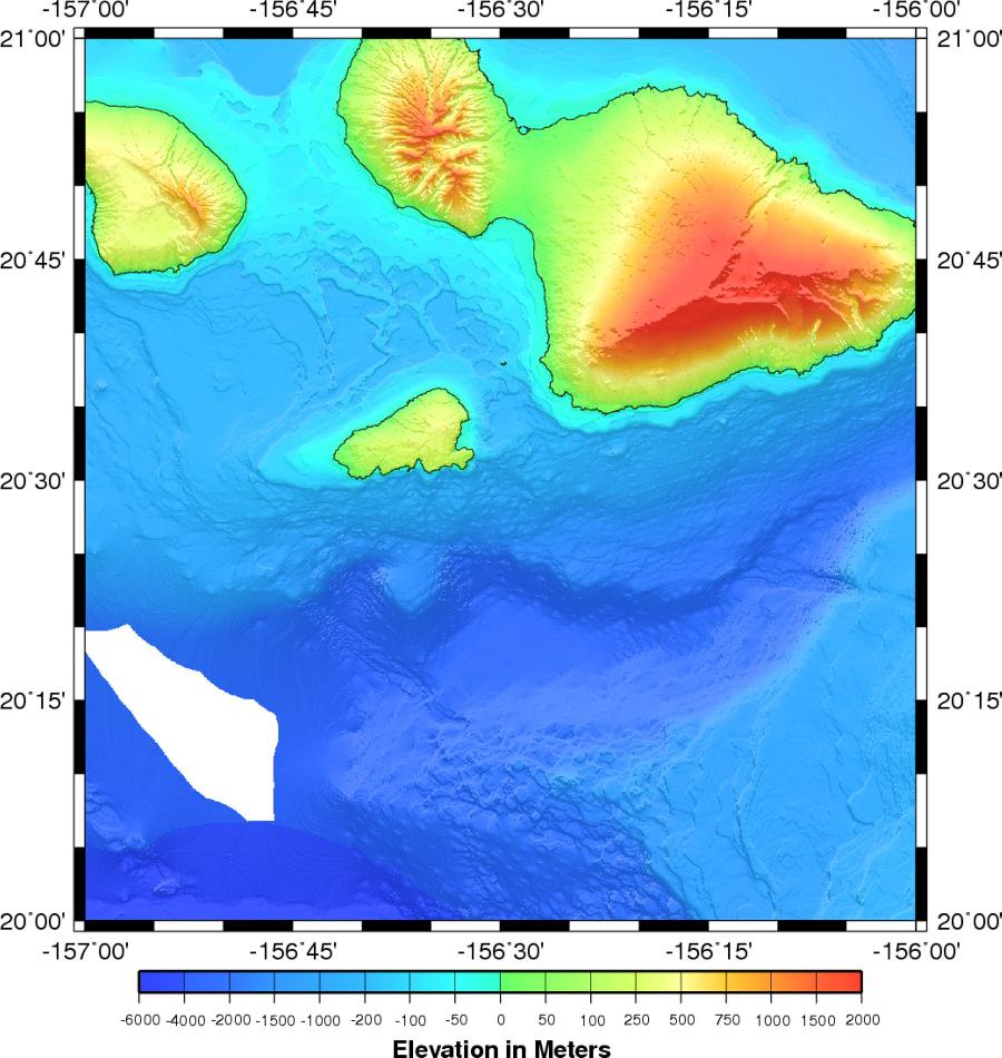
[[Image:Bathymetry.jpg|thumb|Ocean bottom topography, also known as bathymetry, is the measurement of the depth of large bodies of water.]] | [[Image:Bathymetry.jpg|thumb|Ocean bottom topography, also known as bathymetry, is the measurement of the depth of large bodies of water.]] | ||
=== Thermodynamics, engineering, and other sciences === | === Thermodynamics, engineering, and other sciences === | ||
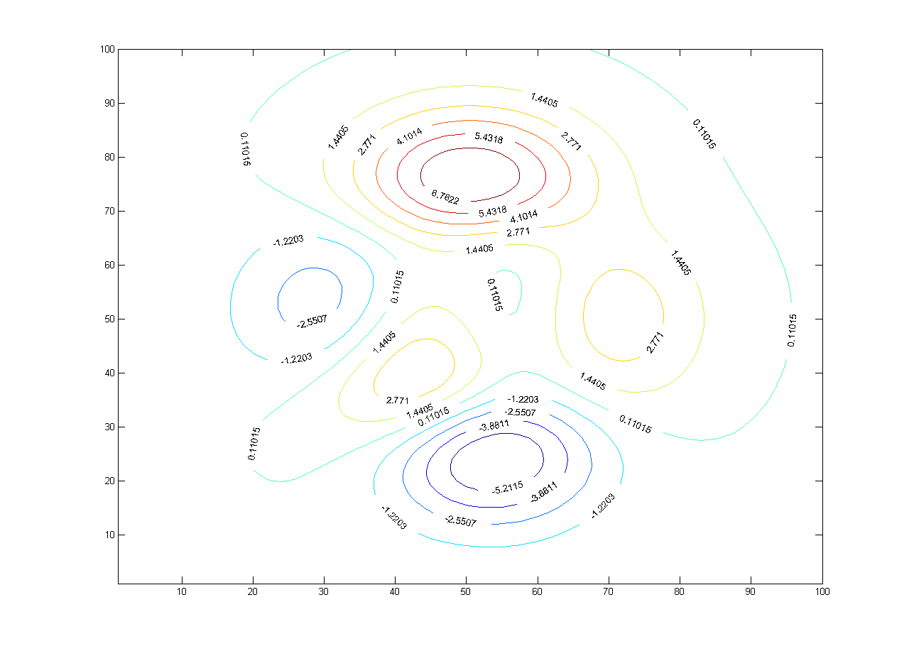
[[image:Contour_map.png|thumb|A contour map with contour lines.]] | |||
---- | |||
==References== | ==References== | ||
* [SAS, 2008] SAS OnlineDoc, SAS. Retrieved at: October 29, 2008. [http://support.sas.com/onlinedoc/913/getDoc/de/sgug.hlp/ctr_index.htm http://support.sas.com/onlinedoc/913/getDoc/de/sgug.hlp/ctr_index.htm] | |||
* [AbAs, 2008] Absolute Astronomy. Retrieved at: October 31, 2008. [http://www.absoluteastronomy.com/ http://www.absoluteastronomy.com/] | |||
* [Wiki, 2008] Contour line, Wikipedia. Retrieved at: October 30, 2008. [http://en.wikipedia.org/wiki/Contour_map http://en.wikipedia.org/wiki/Contour_map] | |||
---- | |||
==External links== | ==External links== | ||
Revision as of 11:12, 31 October 2008
Definition
A contour plot (also contour map) is a graphic representation of the relationships among three numeric variables in two dimensions. Two variables are for X and Y axes, and a third variable Z is for contour levels. The contour levels are plotted as curves; the area between curves can be color coded to indicate interpolated values.
[SAS, 2008]
Types of contour plots
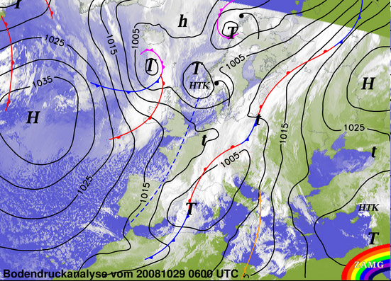
Meteorology

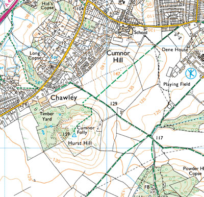
Physical geography and oceanography


Thermodynamics, engineering, and other sciences

References
- [SAS, 2008] SAS OnlineDoc, SAS. Retrieved at: October 29, 2008. http://support.sas.com/onlinedoc/913/getDoc/de/sgug.hlp/ctr_index.htm
- [AbAs, 2008] Absolute Astronomy. Retrieved at: October 31, 2008. http://www.absoluteastronomy.com/
- [Wiki, 2008] Contour line, Wikipedia. Retrieved at: October 30, 2008. http://en.wikipedia.org/wiki/Contour_map