File:Halley.gif
No higher resolution available.
Halley.gif (599 × 352 pixels, file size: 67 KB, MIME type: image/gif)
Description[edit]
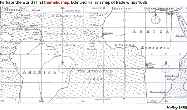
The first map created by Edmond Halley including the information of the direction of trade winds in the Atlantic Ocean.
Copyright status[edit]
Source[edit]
[Ross] Zev Ross, ZevRoss Spatial Analysis. Retrieved at: November 8, 2007. http://www.zevross.com/special/history/halley.gif.
File history
Click on a date/time to view the file as it appeared at that time.
| Date/Time | Thumbnail | Dimensions | User | Comment | |
|---|---|---|---|---|---|
| current | 02:06, 9 November 2007 | | 599 × 352 (67 KB) | UE-InfoVis0708 0525566 (talk | contribs) | The first map created by Edmond Halley including the information of the direction of trade winds in the Atlantic Ocean. |
You cannot overwrite this file.
File usage
The following page uses this file: